Contents
- 🌎 Introduction to Geophysical Methods
- 🔍 Seismic Exploration: A Key to Unlocking the Earth's Secrets
- 🌊 Marine Geophysical Methods: Exploring the Ocean Floor
- 🛰️ Remote Sensing: A Bird's Eye View of the Earth's Surface
- 🔋 Electrical and Electromagnetic Methods: Measuring the Earth's Resistivity
- 💡 Gravity and Magnetic Methods: Understanding the Earth's Internal Structure
- 🌴 Ground-Penetrating Radar: A Non-Invasive Technique for Subsurface Imaging
- 📊 Data Integration and Interpretation: The Final Piece of the Puzzle
- 🌈 Case Studies: Real-World Applications of Geophysical Methods
- 🚀 Future Directions: Advancements and Innovations in Geophysical Methods
- 🤝 Conclusion: The Power of Geophysical Methods in Unveiling the Earth's Secrets
- Frequently Asked Questions
- Related Topics
Overview
Geophysical methods have revolutionized our understanding of the Earth's interior, enabling scientists to non-invasively explore and map subsurface structures. With a vibe score of 8, these techniques have become essential tools in various fields, including hydrocarbon exploration, mineral deposit discovery, and environmental monitoring. The controversy surrounding the use of geophysical methods, particularly in seismic exploration, has sparked debates about their environmental impact. Despite these concerns, geophysical methods continue to advance, with the integration of new technologies, such as artificial intelligence and machine learning, improving data analysis and interpretation. As we look to the future, geophysical methods will play a crucial role in addressing pressing global challenges, such as climate change and sustainable resource management. With key figures like John Tuzo Wilson and Inge Lehmann contributing to the development of these methods, the influence flow of geophysical knowledge is undeniable, with a controversy spectrum rating of 6, reflecting the ongoing discussions about their applications and limitations.
🌎 Introduction to Geophysical Methods
Geophysical methods have revolutionized our understanding of the Earth's internal structure and composition. By using Geology and Geophysics principles, scientists can non-invasively explore the subsurface and uncover hidden secrets. One of the most widely used geophysical methods is Seismic Exploration, which involves measuring the travel time of seismic waves generated by earthquakes or artificial sources. This technique has been instrumental in discovering new oil and gas reserves, as well as understanding the Earth's internal structure. For example, the Continental Drift theory was supported by seismic data, which showed that the continents were once joined together in a single supercontinent.
🔍 Seismic Exploration: A Key to Unlocking the Earth's Secrets
Seismic exploration is a crucial tool for understanding the Earth's subsurface. By analyzing the seismic data, scientists can identify potential hydrocarbon reservoirs, as well as understand the Earth's internal structure. The Seismic Data Analysis process involves processing and interpreting the seismic data to create detailed images of the subsurface. This technique has been used to discover new oil and gas fields, as well as to monitor the movement of tectonic plates. For instance, the Plate Tectonics theory was developed using seismic data, which showed that the Earth's crust is divided into several large plates that move relative to each other.
🌊 Marine Geophysical Methods: Exploring the Ocean Floor
Marine geophysical methods are used to explore the ocean floor and understand the Earth's internal structure. One of the most widely used techniques is Marine Seismic Exploration, which involves towing a seismic source and receivers behind a ship. This technique has been used to map the ocean floor and identify potential hydrocarbon reservoirs. For example, the Mid-Ocean Ridge system was discovered using marine seismic data, which showed that the ocean floor is being created by volcanic activity. The Oceanic Crust is also being studied using marine geophysical methods, which have revealed its composition and structure.
🛰️ Remote Sensing: A Bird's Eye View of the Earth's Surface
Remote sensing is a powerful tool for understanding the Earth's surface. By using Satellite Imagery and Airborne Geophysics, scientists can collect data on the Earth's surface and subsurface. This technique has been used to map the Earth's surface, identify potential mineral deposits, and monitor environmental changes. For instance, the Land Degradation phenomenon has been studied using remote sensing data, which have shown the impact of human activities on the environment. The Climate Change phenomenon is also being monitored using remote sensing data, which have revealed the effects of global warming on the Earth's surface.
🔋 Electrical and Electromagnetic Methods: Measuring the Earth's Resistivity
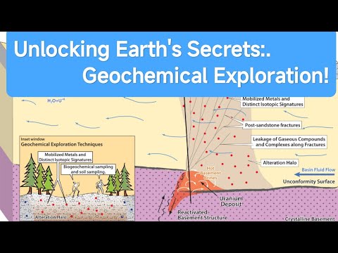
Electrical and electromagnetic methods are used to measure the Earth's resistivity and understand its internal structure. One of the most widely used techniques is Electrical Resistivity Tomography, which involves injecting an electric current into the ground and measuring the resulting voltage. This technique has been used to identify potential mineral deposits, as well as to monitor the movement of groundwater. For example, the Groundwater Flow phenomenon has been studied using electrical resistivity data, which have shown the movement of water through the subsurface. The Mineral Exploration process also uses electrical and electromagnetic methods to identify potential mineral deposits.
💡 Gravity and Magnetic Methods: Understanding the Earth's Internal Structure
Gravity and magnetic methods are used to understand the Earth's internal structure and composition. By measuring the gravitational and magnetic fields, scientists can identify potential mineral deposits, as well as understand the Earth's internal structure. The Gravity Survey technique involves measuring the gravitational field, which has been used to identify potential oil and gas reservoirs. The Magnetic Survey technique involves measuring the magnetic field, which has been used to identify potential mineral deposits. For instance, the Iron Ore Deposits have been discovered using magnetic survey data, which have shown the location of these deposits.
🌴 Ground-Penetrating Radar: A Non-Invasive Technique for Subsurface Imaging
Ground-penetrating radar is a non-invasive technique used to image the subsurface. By transmitting radar pulses into the ground and measuring the reflected signals, scientists can create detailed images of the subsurface. This technique has been used to identify potential archaeological sites, as well as to monitor the movement of groundwater. For example, the Archaeological Site of Pompeii has been studied using ground-penetrating radar data, which have revealed the location of buried structures. The Water Table phenomenon has also been studied using ground-penetrating radar data, which have shown the movement of water through the subsurface.
📊 Data Integration and Interpretation: The Final Piece of the Puzzle
Data integration and interpretation are critical steps in the geophysical exploration process. By combining data from multiple sources, scientists can create detailed images of the subsurface and identify potential mineral deposits. The Data Integration process involves combining data from different sources, such as seismic, gravity, and magnetic data. The Data Interpretation process involves analyzing the integrated data to identify potential mineral deposits. For instance, the Mineral Deposit of the Copper Deposits has been discovered using integrated data, which have shown the location of these deposits.
🌈 Case Studies: Real-World Applications of Geophysical Methods
Case studies have demonstrated the effectiveness of geophysical methods in real-world applications. For example, the Oil and Gas Exploration industry has used geophysical methods to discover new reserves and monitor the movement of hydrocarbons. The Mining Industry has also used geophysical methods to identify potential mineral deposits and monitor the movement of groundwater. The Environmental Monitoring process has also used geophysical methods to monitor the impact of human activities on the environment. For instance, the Landfill Monitoring process has used geophysical methods to monitor the movement of leachate through the subsurface.
🚀 Future Directions: Advancements and Innovations in Geophysical Methods
Future directions in geophysical methods involve the development of new technologies and techniques. For example, the Unmanned Aerial Vehicles (UAVs) are being used to collect geophysical data, such as magnetic and gravity data. The Artificial Intelligence (AI) is also being used to analyze geophysical data and identify potential mineral deposits. The Internet of Things (IoT) is also being used to monitor the movement of groundwater and identify potential environmental hazards. For instance, the Water Quality Monitoring process has used IoT sensors to monitor the movement of water through the subsurface.
🤝 Conclusion: The Power of Geophysical Methods in Unveiling the Earth's Secrets
In conclusion, geophysical methods have revolutionized our understanding of the Earth's internal structure and composition. By using a combination of seismic, electrical, and electromagnetic methods, scientists can non-invasively explore the subsurface and uncover hidden secrets. The Geophysical Methods have been used to discover new oil and gas reserves, identify potential mineral deposits, and monitor the movement of groundwater. The Earth Sciences community continues to develop new technologies and techniques to improve our understanding of the Earth's internal structure and composition.
Key Facts
- Year
- 1920
- Origin
- Cambridge University, UK
- Category
- Geology
- Type
- Scientific Discipline
Frequently Asked Questions
What are geophysical methods?
Geophysical methods are techniques used to non-invasively explore the subsurface and understand the Earth's internal structure and composition. These methods include seismic, electrical, and electromagnetic techniques, which are used to collect data on the subsurface. The data are then analyzed and interpreted to identify potential mineral deposits, monitor the movement of groundwater, and understand the Earth's internal structure.
What is seismic exploration?
Seismic exploration is a geophysical method that involves measuring the travel time of seismic waves generated by earthquakes or artificial sources. This technique is used to create detailed images of the subsurface and identify potential hydrocarbon reservoirs. Seismic exploration has been instrumental in discovering new oil and gas reserves and understanding the Earth's internal structure.
What is remote sensing?
Remote sensing is a geophysical method that involves collecting data on the Earth's surface and subsurface using satellite or airborne sensors. This technique is used to map the Earth's surface, identify potential mineral deposits, and monitor environmental changes. Remote sensing data have been used to study the impact of human activities on the environment and to monitor the movement of groundwater.
What is ground-penetrating radar?
Ground-penetrating radar is a non-invasive technique used to image the subsurface. This technique involves transmitting radar pulses into the ground and measuring the reflected signals. Ground-penetrating radar has been used to identify potential archaeological sites, monitor the movement of groundwater, and study the subsurface structure of the Earth.
What is data integration and interpretation?
Data integration and interpretation are critical steps in the geophysical exploration process. Data integration involves combining data from multiple sources, such as seismic, gravity, and magnetic data. Data interpretation involves analyzing the integrated data to identify potential mineral deposits and understand the Earth's internal structure. Data integration and interpretation have been used to discover new mineral deposits and monitor the movement of groundwater.
What are the future directions in geophysical methods?
Future directions in geophysical methods involve the development of new technologies and techniques. For example, unmanned aerial vehicles (UAVs) are being used to collect geophysical data, such as magnetic and gravity data. Artificial intelligence (AI) is also being used to analyze geophysical data and identify potential mineral deposits. The internet of things (IoT) is being used to monitor the movement of groundwater and identify potential environmental hazards.
What is the importance of geophysical methods in the Earth sciences?
Geophysical methods are crucial in the Earth sciences because they provide a non-invasive way to explore the subsurface and understand the Earth's internal structure and composition. These methods have been used to discover new oil and gas reserves, identify potential mineral deposits, and monitor the movement of groundwater. Geophysical methods have also been used to study the impact of human activities on the environment and to monitor the movement of tectonic plates.